Map of Counties with Transit Services
Image
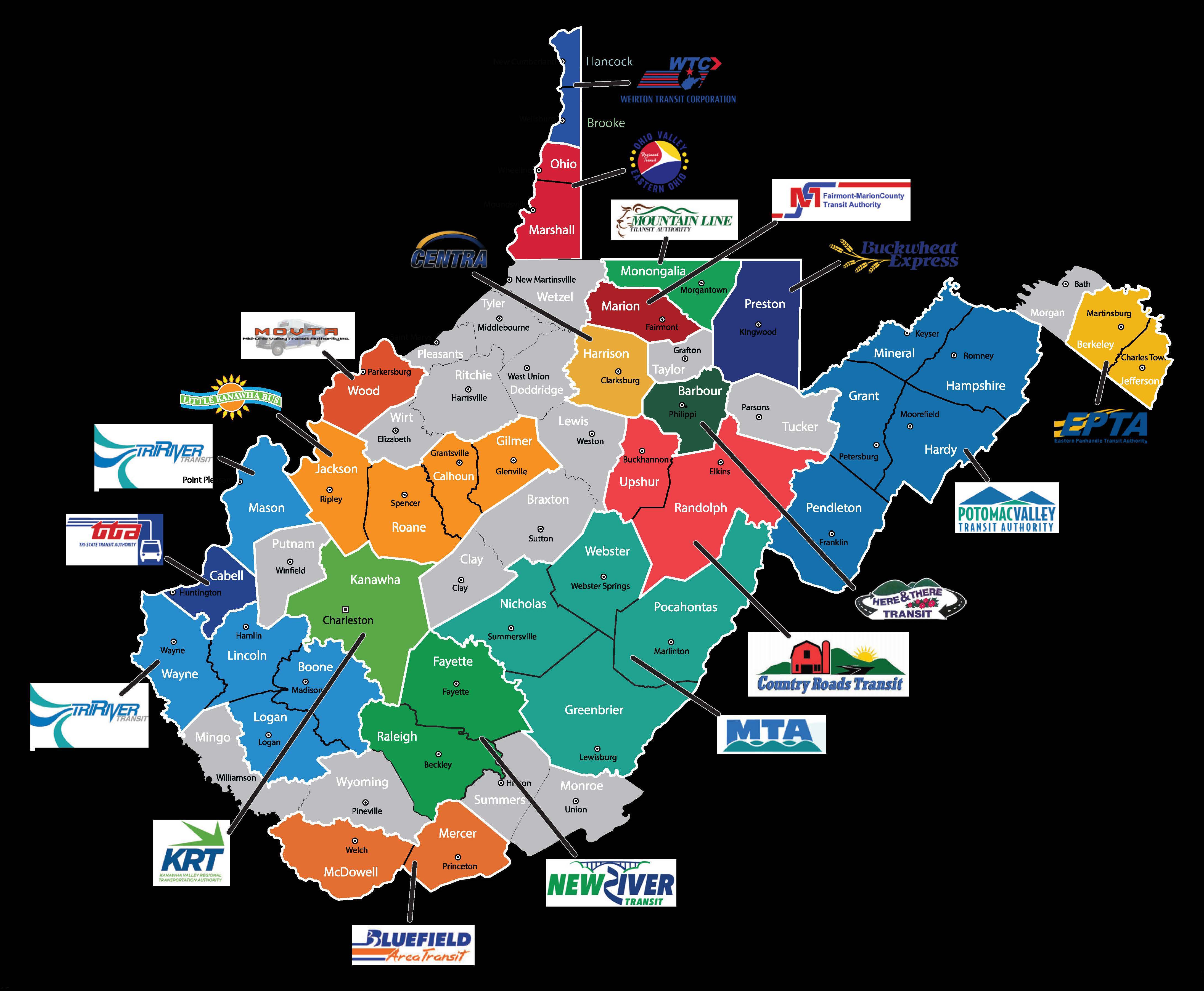
This map divides West Virginia’s 55 counties into two distinct categories based on public transit availability at that time: those shaded in blue (served) and those left white/unshaded (not served).
Map Summary & Legend
- Source Agency: West Virginia Department of Transportation (WVDOT) Division of Public Transit
- Shaded (Blue): Counties Served by Public Transportation
- Unshaded (White/Grey): Counties Not Served by Public Transportation