District 5 Work Zones
Image
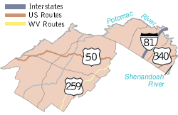
The West Virginia Division of Highways (WVDOH) District 5 manages infrastructure across Berkeley, Grant, Hampshire, Hardy, Jefferson, Mineral, and Morgan counties.
For the most up-to-date and comprehensive list of lane closures and traffic delays, please review the official daily report. Only work activities that are expected to affect traffic are listed.
Download the District 5 Daily Road Report
This report covers active projects across the following roadways:
- Interstate Work Zones (e.g., I-64, I-77, I-79)
- US Route Work Zones (e.g., US 35, US 60, US 119)
- County Work Zones
Information is categorized by the type of roadway and specific county locations.