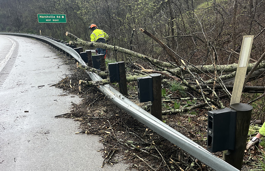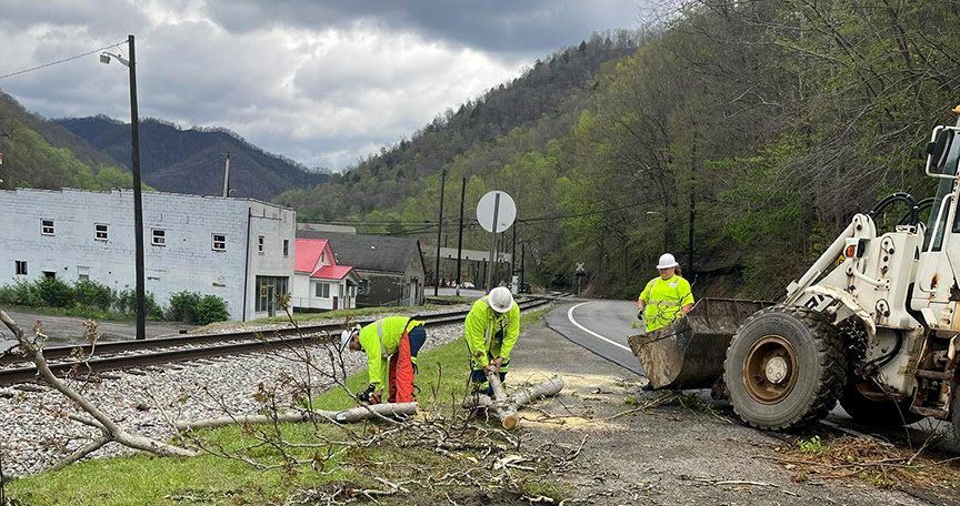
West Virginia Division of Highways (WVDOH) road crews worked overnight and continue to work 24 hours a day to assess and clean up damage caused by a massive storm that moved through the state on Thursday, April 11, 2024.
Most of the state had been under a tornado watch until 9 p.m. Thursday night. Tornados did not materialize, but high winds and a largely stationary storm front dumped record amounts of rainfall on the Kanawha Valley and other parts of West Virginia, leading to mud and rockslides, downed trees and flash flooding.
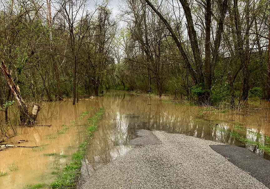
Some parts of the state received five inches of rainfall in the space of several hours.
WVDOH Chief Engineer of Operations Joe Pack, P.E., said the worst of the flooding was concentrated north of Interstate 64. As of 2 p.m. Friday, April 12, 2024, multiple roads remained closed by high water in Kanawha, Cabell, Jackson, Clay, Mason, Lincoln, Pleasants, Wood, Doddridge, Harrison, Marion, Monongalia, Morgan, Brooke, Marshall, Ohio, Tyler, and Wetzel counties.
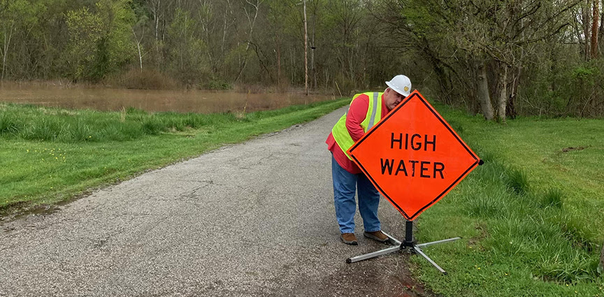
Roads closed at 2 p.m. Friday, April 12, 2024, included:
- Kanawha, Shale Road, culvert washed out.
- Kanawha, Kanawha Two Mile Creek, culvert washed out.
- Kanawha, WV 622, milepost 9.30, high water.
- Kanawha, Holmes Branch Road, culvert washed out.
- Kanawha, Sissonville Drive at Haines Branch, high water.
- Kanawha, WV 214 at Willow Drive, tree and power lines in the road.
- Kanawha, Frame Road, milepost 4.5, tree in road.
- Clay, WV 16 at Hartland Bridge, high water.
- Mason, Salt Creek Road, high water.
- Cabell, Two Mile Creek at East Mud River Road, high water.
- Cabell, Goose Creek Road, high water.
- Cabell, Dry Creek Road, milepost 4.796, high water.
- Cabell, West Mud River Road, milepost 0.01 to 0.40, high water.
- Lincoln, Coal River Road, milepost 7, culvert washed out.
- Jackson, Trace Fork Road, high water.
- Jacskon, Middle Fork Road, milepost 7.05, high water.
- Jackson, Homer Smith Road, high water.
- Jackston, Lower Parchment Valley, high water.
- Jackson, Liverpool Road, high water.
- Pleasants, Middle Island, milepost 0.00 to 2.00, high water.
- Ritchie, County Route 19, high water.
- Ritchie, Prunty Road, high water.
- Ritchie, WV 47, high water.
- Ritchie, Cisco Road, high water.
- Wirt, Fish Hatchery Road, high water.
- Wirt, Burning Springs Road, high water.
- Wirt, Sonoma Road, high water.
- Wood, Walker Road, high water.
- Wood, Stilwell Road, high water.
- Wood, Nicolette Road, high water.
- Doddridge, WV 18, milepost 18.78 and milepost 19.27, high water.
- Marion, Lick Run Road, mudslide.
- Monongalia, River Road, rock fall.
- Morgan, Powerhouse Road low water bridge, high water.
- Brooke, WV 67 at Pennsylvania state line, high water.
- Brooke, Camp Run, high water.
- Brooke, Castlemans Run, high water.
- Marshall, Beelers Station Road, high water.
- Marshall, Big Wheeling Creek Road, high water.
- Marshall, Fish Creek in Lower End, high water.
- Marshall, Dry Ridge Road, high water.
- Marshall, Little Grave Creek, high water.
- Marshall, US 250 at Cameron, high water.
- Marshall, WV 2 at Long Run, high water.
- Marshall, Bells Hill, high water.
- Ohio, Peters Run Road at Skipper Lane, high water.
- Tyler, WV 18, high water.
- Tyler, Indian Creek Road, high water.
- Tyler, Big Run Road, high water.
- Tyler, McElroy Creek, high water.
- Tyler, Sellers Road, high water.
- Wetzel, Van Camp-Paden Fork Road, high water.
- Wetzel, Mannington Road, high water.
- Wetzel, Cappo Run, high water.
- Wetzel, WV 2 at WV 7, high water.
- Wetzel, WV 20 at Folsom, high water.
- Randolph, 1876 Rich Mountain Road, lines down in road.
Such large amounts of rainfall are bound to cause flooding. But, Pack said, “In West Virginia, it’s not the volume of the water but the velocity that causes damage to roads.”
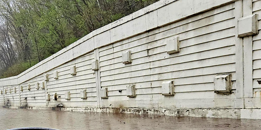
In Kanawha County, record rainfall overwhelmed storm drains on Interstate 64 near the Greenbrier Street exit, flooding the interstate. WVDOH work crews waded into the rushing water with rakes to clear the drains by hand and drain the cascading water away.
WVDOH crews worked overnight Thursday and continue to work Friday to clear downed trees and mud and rockslides. But on roads that are still flooded, work crews must wait until the water recedes to assess any damage to the road.
But Pack said an aggressive core maintenance program over the last several years has significantly reduced damage to Mountain State roads during floods.
“Water is our enemy,” Pack said. “Anything we can do to keep water away from our roadways is going to extend the life of our pavement.”
In addition to keeping ditches and drains as clear of obstacles as possible, WVDOH road crews actively clear trees, limbs, and branches from above roads to allow the sun to shine down and help dry wet pavement. Crews also clear brush from the side of the road for better sight lines and to minimize clogging ditches.
Pack said that, once the water recedes, WVDOH road crews can assess any damage to the roadway and plan any repairs.
