April – September 2019 Status:
The Federal Highway Administration approved the Supplemental Draft Environmental Impact Statement (SDEIS) for the Kerens to Parsons section in Randolph and Tucker Counties in October 2001. Comments regarding the SDEIS were due to the WVDOH by December 7, 2001. Alternative DF has been identified as the preferred alternative. WVDOH received approval for the Supplemental Final Environmental Impact Statement in October 2002. The comment period was extended 60 days to February 25, 2003. The WVDOH received approval of the Amended Record of Decision (AROD) May 12, 2003, and FHWA approved a Reevaluation of that document November 19, 2015.
A P3 contract was awarded to Kokosing in November 2015 for a 7.53-mile section between the existing completed section of Corridor H at Kerens, Randolph County, and the US 219 Connector northeast of Montrose, Tucker County. Completion of that construction contract (grade and drain) is anticipated Fall 2020.
An environmental Reevaluation for the sections between the US 219 Connector and the WV 72 interchange and between the WV 72 interchange and Parsons was approved by the FHWA in late 2017. The DOH anticipates letting a contract in 2019 for an approximate 3.5-mile section that will extend north from the end of the current P3 contract.
In December 2018, the USDOT announced approval of $20 million in federal funds through the BUILD Program to be used for the paving of approximately 10 miles of Corridor H.
Additional construction contracts for the remainder of the Kerens to Parsons portion of Corridor H are anticipated to be let after 2019, as funds are made available.
Mackeyville Interchange DOE Report can be found here.
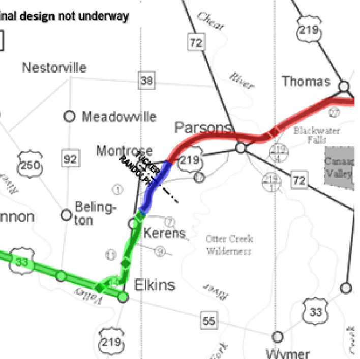
This map is not to scale nor is it an accurate geographic representation of the area. This graphic is for planning and public information purposes only. Distances area approximated to the nearest alignment point.
The above graphic is a portion of the whole map. Please click here to view the entire map at full-size (135k).
If you would like a very detailed description of a certain area, please contact us and we will be happy to provide you with that information.