April – September 2019 Status:
After discovering evidence of the West Virginia Northern Flying Squirrel, a Federally Endangered Species, the WVDOH completed additional environmental investigations throughout the 10-mile area between Parsons and Davis in Tucker County.
The Supplemental Draft Environmental Impact Statement (SDEIS) on the segment was approved on December 4, 2002. A public hearing was held February 6, 2003 at the Blackwater Lodge in Davis. Comments were due by April 22, 2003. The Thomas and Davis City Councils had an additional 60 days (until September 30, 2003) to review the preferred alternative recommendation. The Supplemental Final Environmental Impact Statement was approved by the Federal Highway Administration on February 2, 2007, and comments regarding the SFEIS were due August 1, 2007. A SEIS is underway.
Final design of this segment through Tucker County is anticipated to begin in 2023. Construction tentatively is scheduled to begin in 2024.
A copy of the following documents can be found below:
1992 Corridor Selection Draft Supplemental Environmental Impact Statement (DEIS)
1993 Corridor Selection DEIS Decision Document
1994 Alignment Selection Supplemental Environmental Impact Statement (ASDEIS)
1994 Alignment Selection Air, Noise and Energy Technical Report
1994 Alignment Selection Secondary and Cumulative Impacts Technical Report
1994 Alignment Selection Streams Technical Report
1994 Alignment Selection Vegetation and Wildlife Habitat Technical Report
1994 Alignment Selection Wetland Technical Report
1996 Final Environmental Impact Statement
Volume I - Narrative
Volume II - Tables, Exhibits, Figures &; Appendices
Volume III - Mitigation Document
1996 Record Of Decision
2000 Section 106 Programmatic Agreement
2000 Settlement Agreement
2003 Blackwater Preferred Alternative Report
2003 Draft Supplemental Environmental Impact Statement
2004 Preferred Alternative Report
2007 Preferred Alternative
A copy of the 2007 SFEIS can be found here.
2017 Alignment and Resource Location Plans
Blackwater Industrial Complex COE Report
Updated Eligibility Report - 2-15-23
Parsons to Davis 2023 COE
Core Boring Activities 2023
Project Location and Status
Project Summary
Project Maps
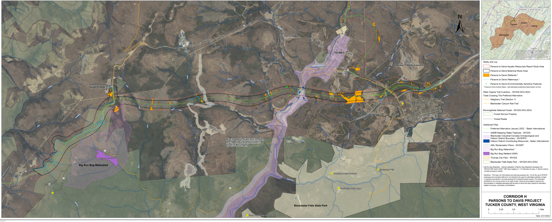
This map is not to scale nor is it an accurate geographic representation of the area. This graphic is for planning and public information purposes only. Distances area approximated to the nearest alignment point.
Please click here to view the entire map at full-size (80mb).
If you would like a very detailed description of a certain area, please contact us and we will be happy to provide you with that information.